
OSS GIS Migration: Reduce Risk and Modernize Fiber Planning
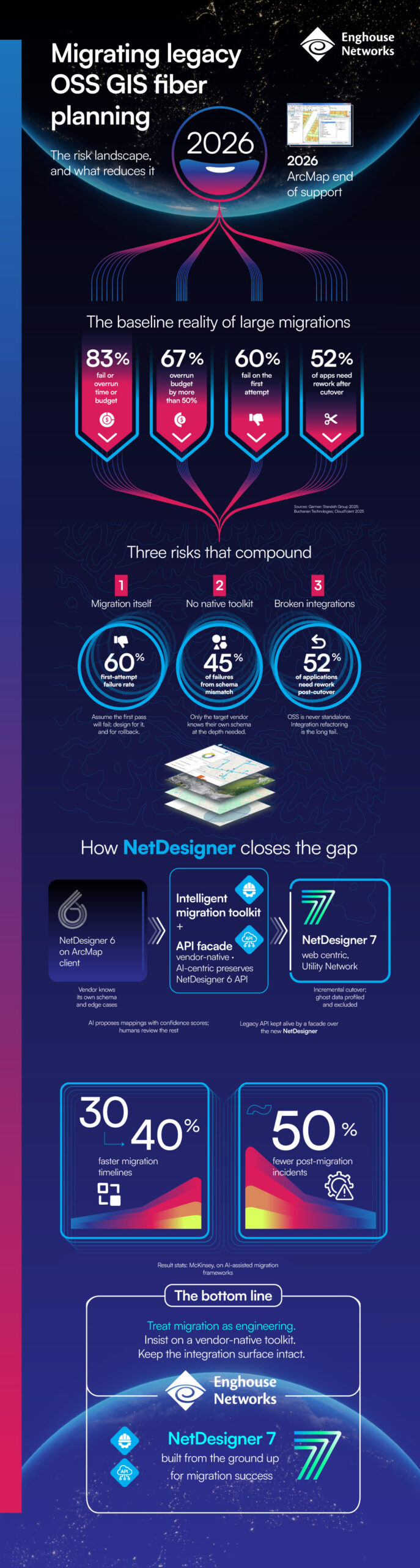
Migrating legacy OSS and GIS systems is becoming a priority as platforms approach end of support and network demands continue to grow. For many operators, especially those managing fiber networks, the challenge is not just moving data—but ensuring continuity across planning, operations, and integrations.
Most migration projects face delays, budget overruns, or require rework after cutover. These risks often come from schema mismatches, limited tooling, and complex OSS dependencies.
Planning a Migration? Read This First
The infographic highlights the key challenges. The next step is understanding how to navigate them.
Migrating OSS GIS fiber planning systems is not a simple upgrade. It’s a shift to a fundamentally different data model that impacts every integration, workflow, and dataset across your network. Most failures don’t come from moving data, but from losing the meaning behind it – when structure, logic, and dependencies no longer align.
Download the Migration Whitepaper
The Migration Whitepaper takes this further, examining what actually happens inside large-scale OSS GIS migrations – and why so many go off track.
It explores the transition from Geometric Network to Utility Network, where there is no direct mapping between old and new models, and where years of operational logic are often embedded within the data itself. It also looks at how schema mismatches, legacy conventions, and “ghost data” introduce risks that often surface only after cutover.
More importantly, it outlines a more controlled approach – using vendor-native, AI-assisted tooling to interpret and validate data, while preserving integrations through an API facade so operations continue without disruption.
If you’re planning a migration, this provides a practical, technical perspective to help reduce risk, avoid rework, and move forward with confidence.